The purpose of the project is to establish information system to support flood mitigation planning and warning activities, as well as providing accurate and consistent tools for decision support system in order to enhance the efficiency of water resource management in the project area.
The project’s scope of work included :
1. Created implementation plans and developed a network of hydrological and meteorological telemetering stations which provide real-time data to be primarily
used for flood forecasting, early warning system, water quality monitoring, and flood management system that will improve efficiency of water resource management
in the Bang Pakong river basin.
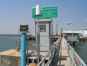
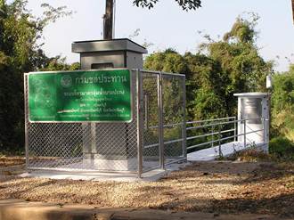
2. Developed a new and improved the link and integration system of the existing network that can be seamlessly integrated with the expanded system. The existing networks include the following remote telemetering stations located in the Bang
Pakong river basin:
- Horthong Station, Amphoe Ban Sang, Prachin Buri province.
- Somboon Station, Amphoe Ongkharak, Nakorn Nayok province.
- Phanthong Station, Amphoe Bang Pakong, Chachoengsao province.
- Ban Pho Station, Amphoe Ban Pho, Chachoengsao province.
- Saphan Chachoengsao Station, Amphoe Ban Pho, Chachoengsao province.
- Bang Pakong Diversion Dam, Amphoe Mueang Chachoengsao, Chachoengsao province.
The data acquired from both existing and expanded networks is not only
integrated but also applied to flood forecasting model also developed
under the project.
3. Improved and enhanced the capabilities of the existing flood forecasting system based on state-of-the-art mathematical modeling and developed a reliable and consistent early warning system for automatic real-time flood forecasting and
warning applications.
4. Developed a decision support system (DSS) used for flood management in the Bang Pakong river basin.
5. Established data base system that is compatible and applicable to other systems or activities (e.g. public information and warning system)
|